Where Stone, Sea, and Time Reveal Hidden Roads
Step into the shifting world of Cornwall’s tidal causeways and broad, breathing flats, where granite ridges meet Atlantic energy and centuries of waves shape paths that appear, then vanish. Today, we explore the geology and coastal processes shaping Cornwall’s tidal causeways and flats, translating rock histories, sand journeys, and tide cycles into compelling stories, practical insights, and safe, enriching adventures you can experience and share.
Ancient Rocks Beneath the Tides
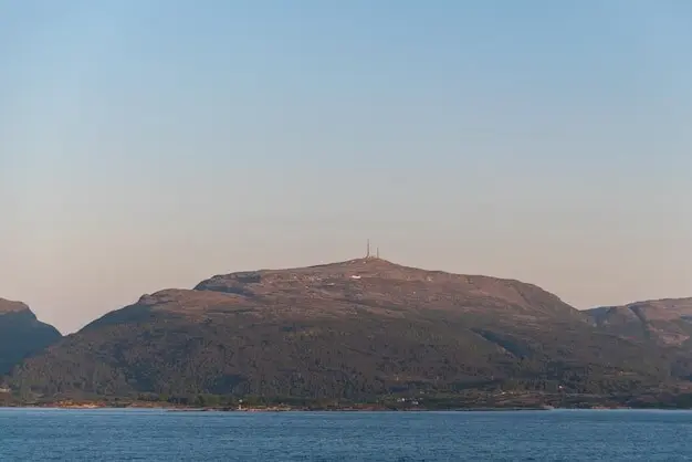
The surface may glimmer with ripples and wrack lines, yet every safe crossing depends on structures forged deep in time. Cornwall’s granite intrusions, metamorphic aureoles, and contrasting slates and sandstones create resistant spines and softer pockets, guiding where causeways persist and where flats spread. By understanding these bedrock mosaics, we grasp why certain routes hold firm underfoot while neighboring sands drift restlessly with each tide and storm.
Waves, Wind, and Tidal Energy Interplay
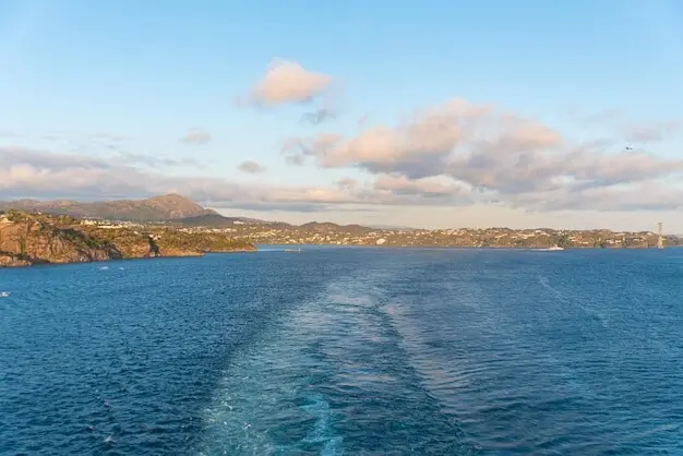
Cornwall sits open to powerful Atlantic swell, yet its embayments, headlands, and tidal ranges choreograph moments of calm that reveal firm paths. Spring tides widen crossing windows, while storms compress them, altering safety by the hour. Longshore drift streams sand along littoral cells, sometimes nourishing flats and sometimes starving them. Appreciating these rhythms helps you time each journey, read weather forecasts intelligently, and respect how invisible forces sculpt tomorrow’s route beneath today’s gentle ripples.
Spring–Neap Cycles and the Art of Perfect Timing
Spring tides, aligned with new and full moons, lower water levels and can briefly extend safe passage across causeways, while neap tides narrow opportunities. Yet wind setup, barometric pressure, and residual swell can shift predictions meaningfully. Experienced locals watch for subtle cues: distant breaker lines, the speed of ebbing currents, and gull roosts relocating seaward. Pairing tide tables with real-time observations turns cautious planning into a confident, delightful walk rather than a rushed, anxious retreat.
Storm Surges, Overtopping, and Hard-Won Wisdom
When deep lows sweep across the Atlantic, storm surges lift sea levels and unleash energetic waves that overtop even robust causeway crests. Each event rearranges cobbles, scours mortar, and carves rills guiding future flows. After such nights, both locals and coastal engineers inspect damage, noting new hollows and perched berms. The community’s collective memory—stories of near-misses, rescued picnics, and lantern-lit returns—embeds practical wisdom that transforms abstract risk into respectful, safer practice for tomorrow’s visitors.
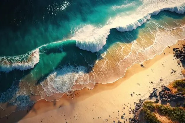
Sediment Journeys Across Flats and Channels
From Rockface to Footpath: A Grain’s Lifelong Tour
A fresh granite spall tumbles from a joint, grinds into grit, then polishes into sand. Ebb currents sweep it seaward; flood tides nudge it back into lee zones. On calm days it rests, forming crisp ripples; in storms it sprints across bars. When you step upon that subtle ridge, you feel its migration paused beneath your boots, a story of fatigue, reshaping, and return inscribed across seasons of patient coastal motion.
Bar Migration, Channel Switching, and Surprise Rewrites
Tidal bars march shoreward or seaward depending on wave period and storm frequency, while channels abandon old paths to carve sudden shortcuts. A familiar crossing may shift a few paces each month, then leap meters after one fierce gale. Tracking buoyant wrack lines, eelgrass clumps, and sediment color bands reveals active pathways. Such attention not only improves footing and safety but also invites you to witness living geomorphology unfolding at a human, memorable scale.
Mud, Algae, Cohesion, and Slippery Truths
Fine silts and clays flocculate in quiet waters, binding into cohesive beds often capped with green or brown algae. These surfaces can appear inviting yet transform into treacherous slides under a thin sheen of water. Waders and local fishers read microtopography—pinprick worm casts, sheen changes, and footprints holding water. Respecting such cues prevents stumbles and enriches each walk, turning the avoidance of hazards into an experience of intimate, scientifically informed observation.
Stonework Reading Currents Like Old Friends
Successful causeway builders placed setts with an eye to flow: tight joints where jets accelerate, open crescents where water needs quiet relief. Gentle cambers shed puddles; subtly raised shoulders nudge channels away. Look closely and you’ll see practical geometry echoing hydrodynamic truths learned through winters of trial. Each repair continues this conversation with tide and wave, honoring past craft while refining surfaces so feet find grip and storms find less to tear away.
Harbors, Dredging, and Hungry Shores
A dredged fairway keeps boats moving but can deprive neighboring beaches of sediment, deepening channels that siphon sands from flats. Groynes and seawalls fix one boundary while shifting erosion elsewhere. Coastal plans now weigh such knock-on effects, asking how to nourish instead of starve. Citizens can help by documenting before-and-after conditions, sharing photographs of bar positions, and supporting adaptive strategies that treat each cove as part of a connected, responsive sediment economy.
Stories of Crossings, Lanterns, and Laughter
Ask a local about a misty evening when a moonlit ebb gifted an unplanned feast on the sands, or the time a sudden flood turned a stroll into a splashy sprint. These stories carry gentle warnings and joyful gratitude, teaching newcomers where puddles linger longest and which shortcuts betray confidence. Share your own respectful adventures, subscribe for seasonal updates, and join a community that celebrates access while prioritizing care for the coast’s delicate, hardworking edges.
Human Footprints on the Intertidal Edge
Cobble-laid paths, harbor walls, and protective revetments intersect nature’s designs, sometimes reinforcing durable lines, sometimes disrupting sediment budgets. Historic crossings reveal generations learning from tides and storms, embedding wisdom in stone alignments and drainage cuts. Yet modern pressures—tourism, dredging, coastal defenses—can starve adjacent flats or trigger unintended channels. Balancing heritage access with living shoreline function requires sensitivity, community dialogue, and an abiding understanding of processes shaping each captivating, ever-renewing corridor between land and sea.
Weather, Climate Shifts, and What Comes Next
Rising seas, shifting storm tracks, and altered wave climates are already rewriting intertidal scripts. Windows for crossings may shorten, bars may sit higher or break more often, and flats could either expand with new sediment supply or thin under energetic futures. Anticipating change means blending data with local practice: using forecasts, monitoring tools, and shared logs to adapt. Curiosity, prudence, and community science can keep cherished paths open, meaningful, and safe longer.
Fieldcraft: Reading the Landscape Like a Local
Great journeys begin before boots meet cobbles. Study charts, watch the horizon for swell trains, and walk the strandline noting drift patterns, shell clusters, and the tone of wet versus drying sand. Kneel to feel ripples, sniff seaweed freshness, and listen for channel chatter. Then share what you learn—post photos, join monitoring days, and subscribe for seasonal alerts—so every visitor benefits from a growing, generous library of careful, shared intertidal wisdom.
All Rights Reserved.